UAVs (Drones) have become a universal resource for the Real Estate and Development industries, most notably for capturing aerial photos or smooth aerial video to showcase a property. The beauty captured from a birds-eye view is unparalleled and this perspective to highlight a large format property is invaluable to an agent or broker.
However, due to legal guidelines as a licensed Part 107 FAA Remote Pilot (Drone Pilot), we sometimes have to add some extra creativity to capture the views and perspectives required by our clients. Some of the more common restrictions are avoiding a 5 mile radius of airports (unless you’ve received permission from the local ATC) and not flying over large crowds. But another restriction that can hinder a project is the altitude limit; we cannot legally fly higher than 400 feet MSL (mean sea level, or above sea level), unless avoiding a potential hazard.
You would be surprised how limiting 400ft in altitude can be when trying to capture the entire scope of a large property or development. So, enter the creativity.
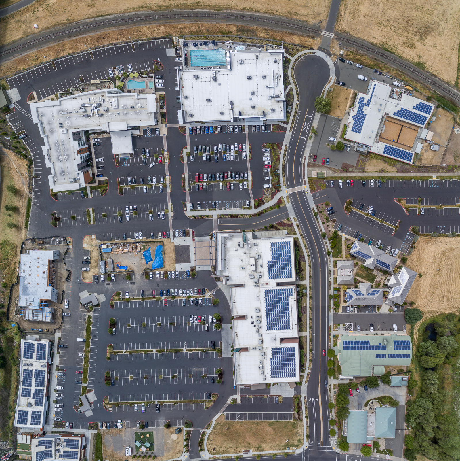
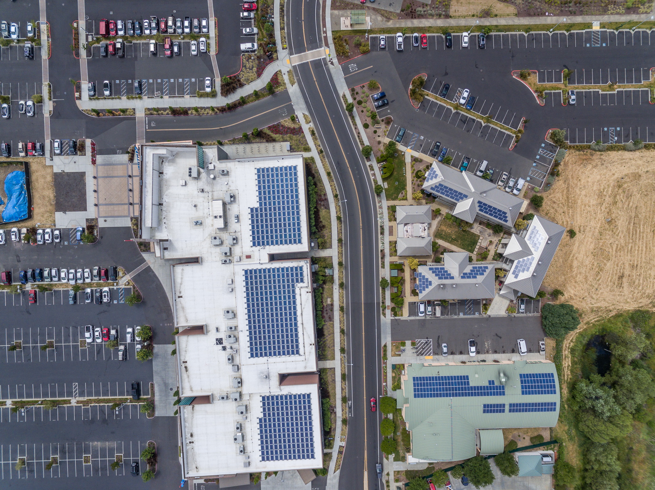
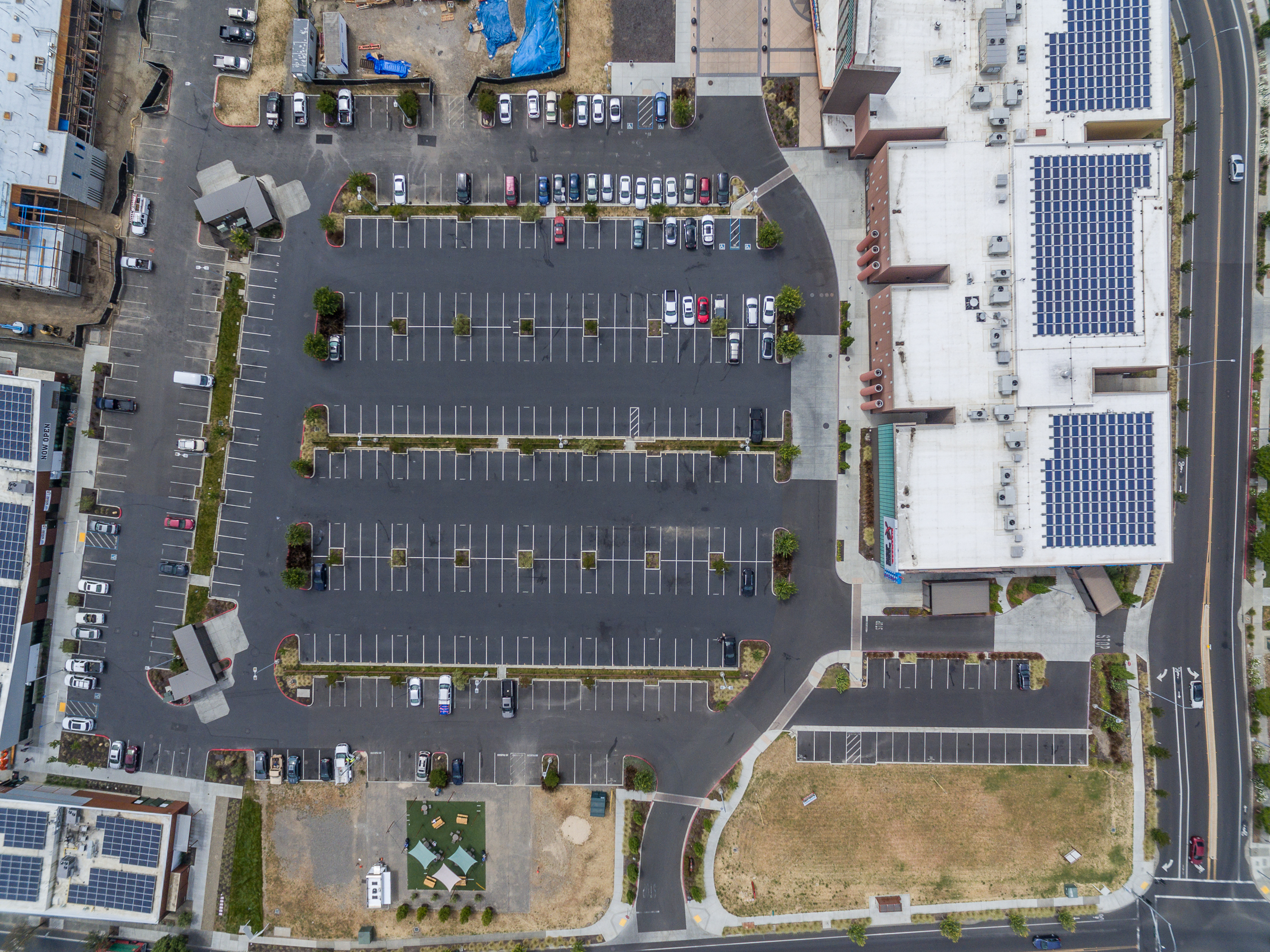
I was recently tasked with capturing a large scale development, multiple buildings, parking lots, construction, and spaces for future lease. A common request with this type of project is a birds-eye view looking straight down at the property, similar to what you might see in Google Maps. However, at 400ft, you’re lucky to capture maybe a square acre in a single frame.
For this particular project, I cautiously navigated my UAV at about 350ft in altitude in a grid type pattern over the entire property. Over the weekend I carefully merged each image in post-processing to develop a composite of 10+ different shots in to one large format image, resembling a map. The results were surprisingly accurate to scale and quite useful for the client!
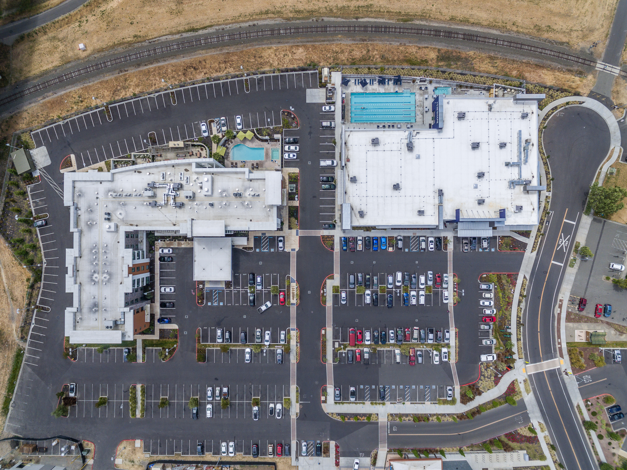
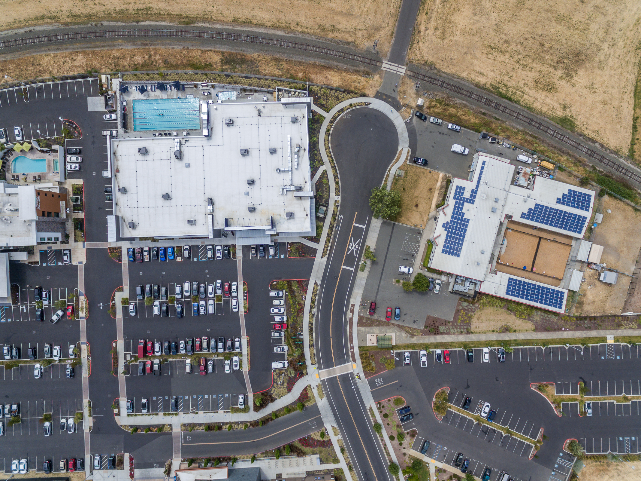
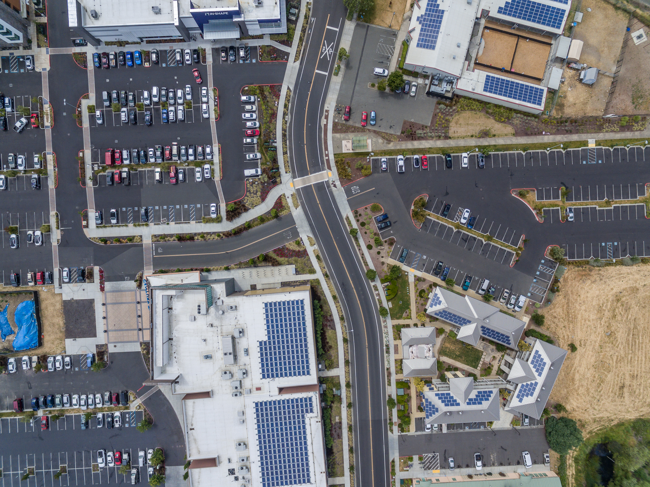
Below is the final image with some of the individual shots following.
Just another great example of how dynamic and helpful the Drone Industry as become!
If you’re in need of Aerial Photography or Video services, we’re available for hire in the Bay Area, Napa County, and Greater Sonoma County areas. Reach out today at: Darren@aerialphotomedia.com or simply sent me a message via LinkedIn.
Unparalleled quality, several years of experience, great customer service.